
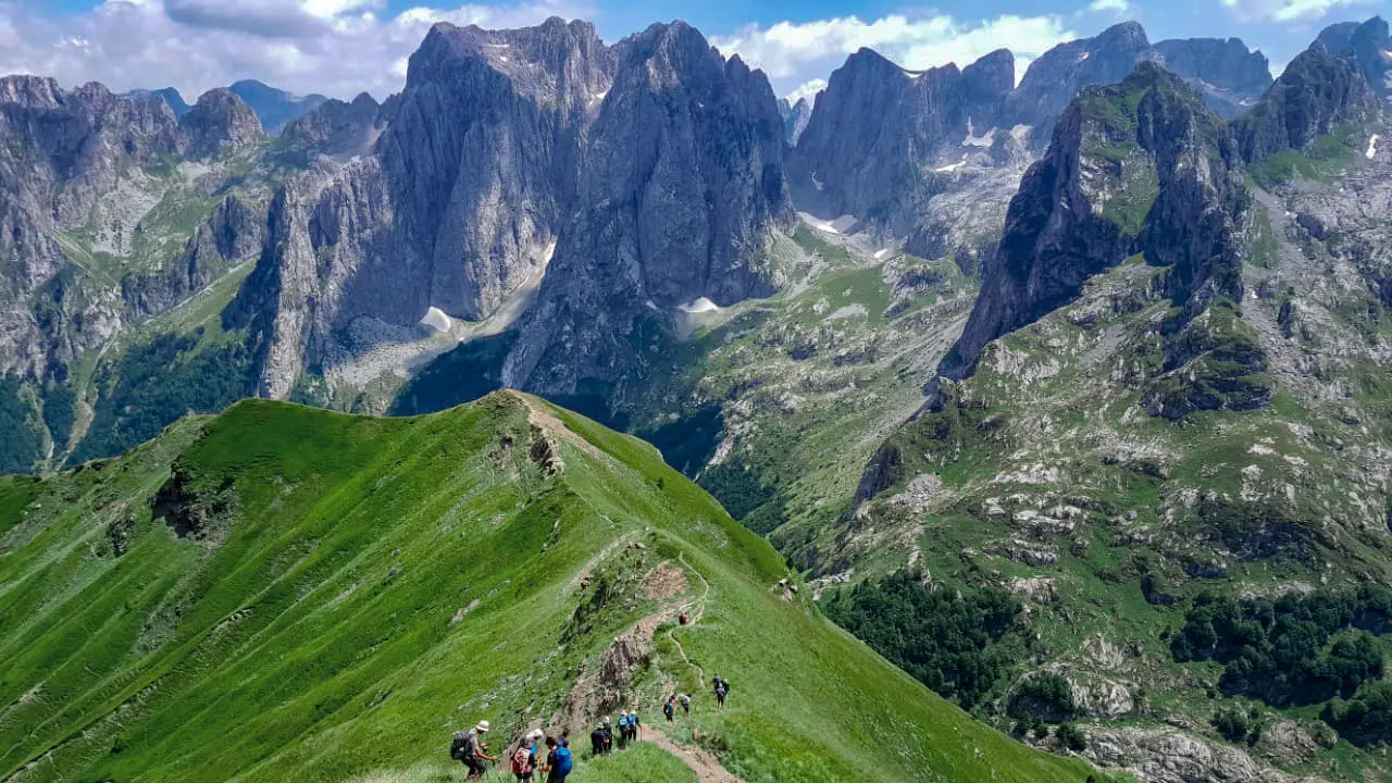
The Valbona Pass is a day when the landscape changes with every step: the scattered houses of Theth, a beech forest, then the limestone slopes and summits of the Albanian Alps. This Theth–Valbona hike is one of the best-known crossings on the Peaks of the Balkans. But behind the photos there is also a real climb, stones underfoot and a long descent. Here is how the day unfolds, and how to set off well prepared.
Covered on this page:
- Why the Valbona Pass has become an essential crossing
- Setting off from Theth: leaving the village behind
- Above the beeches: legs working, the view opening up
- At the pass: Maja e Jezercës and the hidden valleys
- Towards Valbona: the descent is still part of the effort
- How hard should you expect this Peaks of the Balkans stage to be?
- Sorting out access and setting off well informed
- Frequently asked questions
Why the Valbona Pass has become an essential crossing
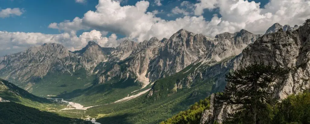
The Valbona Pass, or Qafa e Valbonës, links two emblematic valleys of the Albanian Alps: to the west, the Shala valley and the village of Theth; to the east, the Valbona valley. It lies at about 1,795 metres above sea level, although some guides and maps round that height up to more than 1,800 metres.
Long before the Peaks of the Balkans cross-border route was waymarked, this crossing was already a classic day hike in northern Albania. Even today, walkers with only a weekend choose this single stage. One day, two valleys and a mountain pass: the promise is simple, but it doesn't lack grandeur.
Both valleys now belong to the Albanian Alps National Park, created in January 2022 by merging the former Theth and Valbona Valley national parks and the Gashi nature reserve. Here, the crossing isn't just about the moment you reach the pass. The whole path deserves your attention.
Setting off from Theth: leaving the village behind
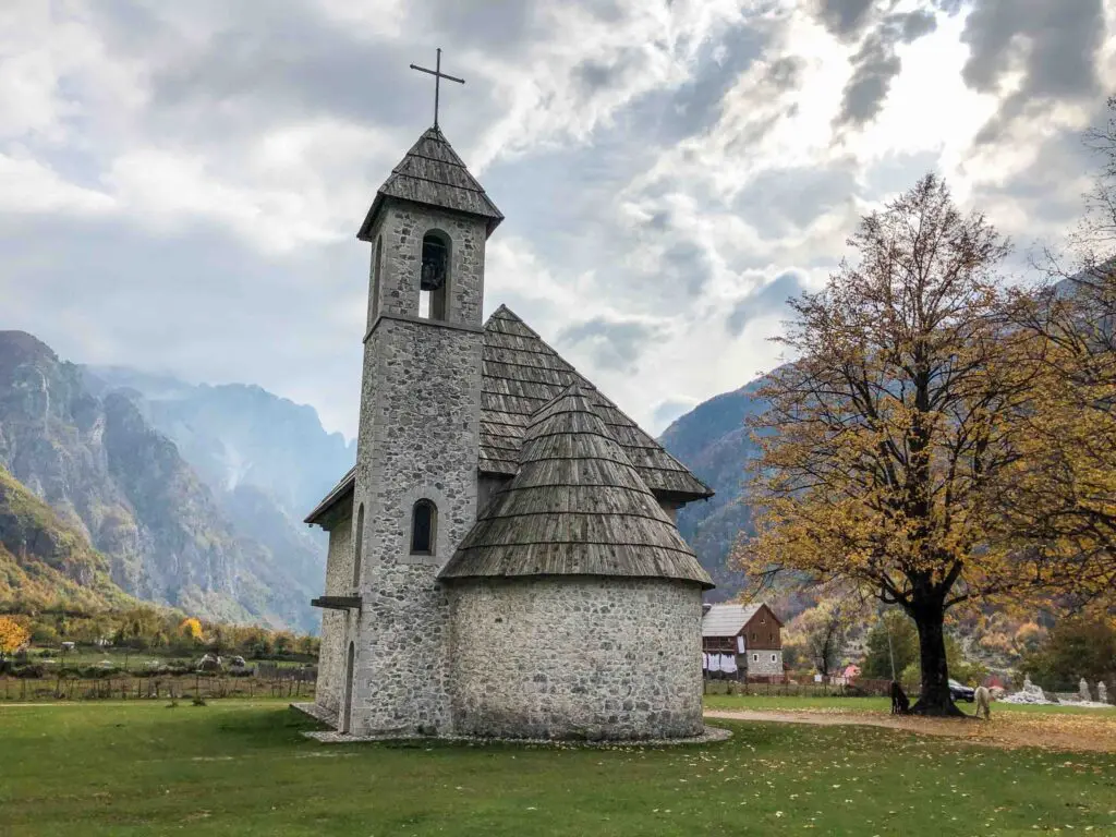
The day starts in Theth, a scattered village at about 750 metres above sea level. Even before you gain height, two buildings near the way out make you want to slow down: the Catholic church and the Kulla, the old refuge tower.
Built in 1892, the church was used for other purposes during the communist period, before being restored after 1990. Those first minutes are a reminder that you're not only crossing a mountain backdrop, but also lived-in places with their own history.
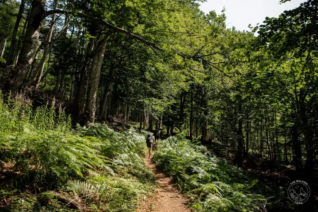
Then the trail begins to climb. The first part follows a well-used mule track through a beech forest. The switchbacks gain height quickly and the ascent stays steady. This is the time to find your own rhythm, rather than trying to follow someone else's.
There is generally shade as long as the trees stay dense. An early start makes this climb more pleasant, before the heat sets in. The forest thus offers a gradual transition between the village and the open slopes waiting higher up.
Above the beeches: legs working, the view opening up
As you climb, the forest thins. The beeches give way to limestone slopes, scree and alpine meadows. Underfoot, the trail becomes stonier. Behind you, the Theth valley opens out: a good reason to stop for a moment and look at the ground you've covered.
This section calls for more attention to your footing. It isn't technical climbing, but loose stones don't always let you walk without watching where you put your feet. The beauty of the landscape and the effort go together. Yes, you'll want to admire the summits. Yes, your legs will also remind you that you're climbing.
Near the pass, snowfields can persist on shaded slopes well into early summer. Crossing them is often straightforward, but they can be slippery in the morning. A snowy section is therefore worth slowing down for and assessing the conditions, even if the rest of the trail seems easy.
Above the trees, shade is scarce. This is also where sun protection, water and the clothes you've packed really come into their own. In the mountains, the contents of your bag are more than a list ticked off the night before.
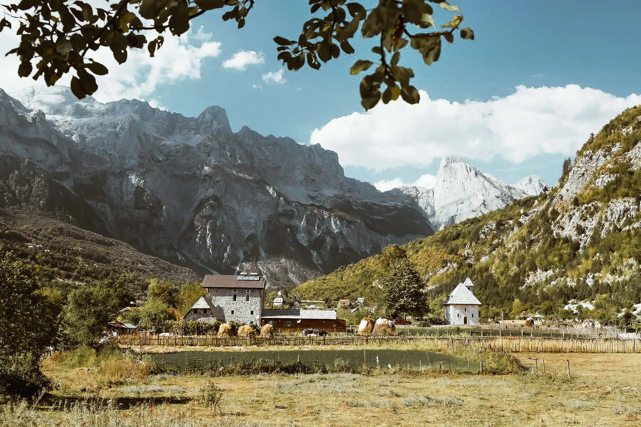
At the pass: Maja e Jezercës and the hidden valleys
At the pass, your gaze meets a line of jagged limestone summits. Among them, Maja e Jezercës dominates much of this stage. At 2,694 metres, it is the highest peak of the Albanian Alps and of the whole Dinaric range. It rises between the Shala and Valbona valleys.
The surrounding massif is called Bjeshkët e Nemuna in Albanian and Prokletije in Montenegrin, generally translated as “the Accursed Mountains”. Faced with these peaks, the name takes on a very different dimension from a simple mention on a map.
A short detour near the pass leads to a viewpoint over Curraj i Epërm. This remote valley shelters a small hamlet that most hikers never see. It is another facet of the crossing: beyond the summits, it gives a glimpse of the isolation of these mountain communities.
In clear weather, the light changes quickly on the limestone walls. Early morning and late afternoon are particularly photogenic. But don't let the search for the perfect photo take priority over the weather: the pass is exposed, and conditions can change quickly.
Towards Valbona: the descent is still part of the effort
Crossing the pass doesn't mean the day is over. On the Valbona side, the descent is long and steady. It first crosses scree and grassy slopes, then returns to forest towards the valley floor.
After the climb, the change is welcome, but your legs keep working. On loose stones, poles can really help. Save some energy for this second part: the Theth–Valbona hike isn't just an ascent followed by a gentle stroll.
In summer, a few seasonal cafés and shepherds' huts offer drinks, coffee and sometimes something to eat. A break can be welcome, but don't count on them being open for your supplies. It depends on the season and on the owners.
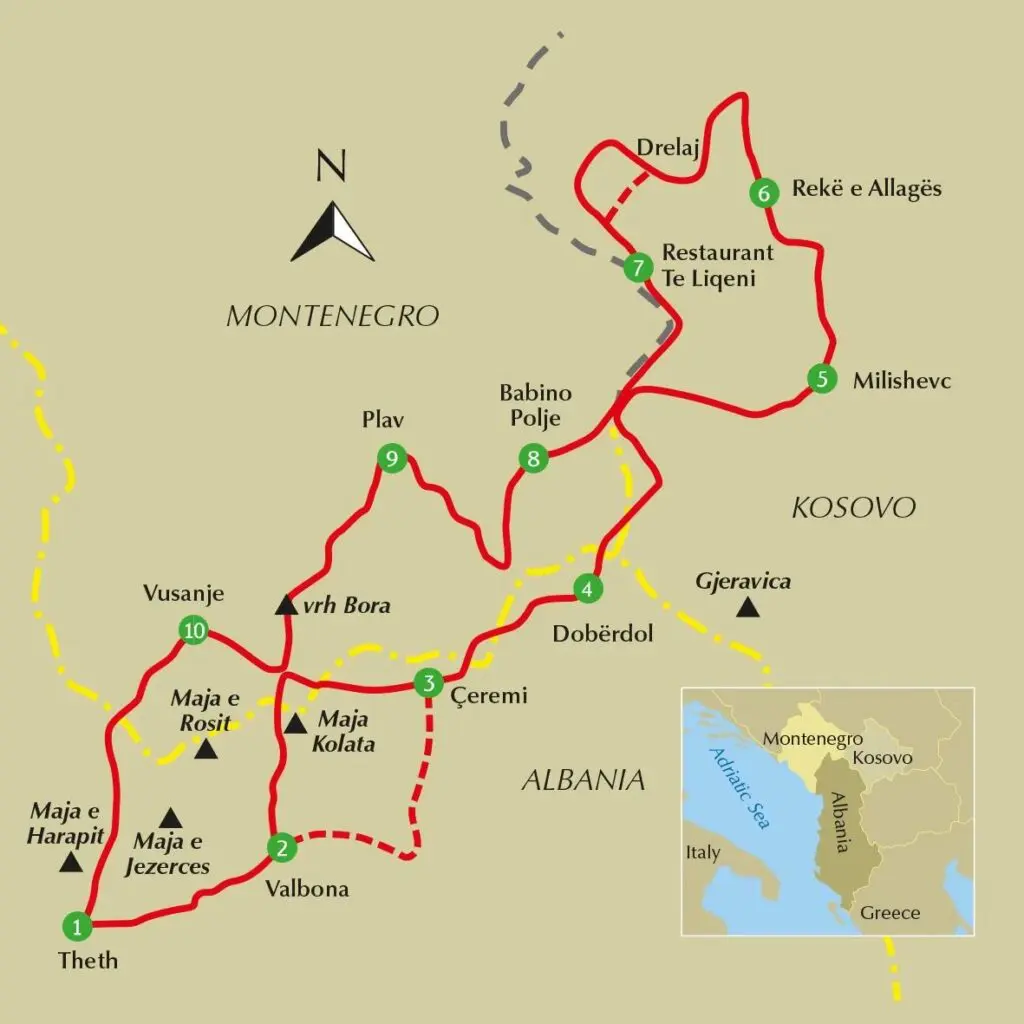
On The Balkan Trail, this crossing is the second day of the trip, the first one devoted entirely to walking. The stage is 11.6 kilometres, with 1,060 metres of ascent and 680 metres of descent, followed by a van ride to the guesthouse in Valbona. The start is from the base camp in Theth, passing the church and the Kulla.
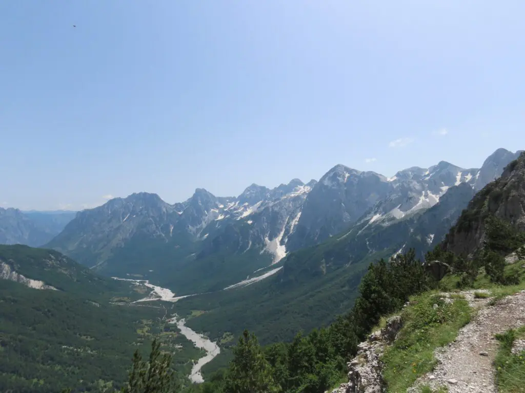
How hard should you expect this Peaks of the Balkans stage to be?
Depending on the start and finish points, generally allow 11 to 17 kilometres, about 900 to 1,200 metres of ascent and 700 to 900 metres of descent. Most hikers take between six and eight hours, breaks included. These are guidelines for preparing your day, not a stopwatch to beat.
The terrain alternates good mule track, loose stones and scree. Regular fitness and sure footing count for more than climbing experience. In the Theth–Valbona direction, you tackle the steeper side on the way up. Doing the route the other way round reverses the effort and saves a long descent, hard on the knees, for the end of the day.
The weather is the other important point. A sunny morning can give way to a thunderstorm in the afternoon. On The Balkan Trail, Travelbase guides and an accredited local guide look after the group, with one guide in front and another behind. You walk at your own pace, but the group stays together in bad weather. The arrangements are detailed in the trip FAQ.
Your pack, without counting on the cafés
- Water: take enough and check locally the day before on the springs, whose flow varies with the season.
- Clothing: take a waterproof jacket and a warm layer, even if the day is forecast to be hot.
- Sun: a hat, sunglasses and sun cream are useful above the forest.
- Footing: choose shoes you've already worn, with good grip. Trail shoes suit some people, but the stones and snowfields favour sturdier shoes.
- Navigation: download a map or a GPX track before you leave, as mobile coverage is patchy.
- Small expenses: bring cash in small notes, as the shops along the trail have no card terminal.
For the detail of what to pack, see the kit list.
Sorting out access and setting off well informed
You reach Theth by road from Shkodër, via Boga. The condition of the road can vary with the season, so check before you set off. Valbona can be reached from Bajram Curri.
In summer, a common way to link the two valleys by public transport is the Koman lake ferry (this crossing is not part of the Balkan Trail programme). Timetables vary by operator and season: check the official timetables of one of the operators rather than relying on an old hiking account.
Finally, if you have a health condition, talk to your doctor or a travel clinic about a multi-day mountain hike before you leave. Preparing this crossing well leaves you more room to enjoy the path.
Thinking about the Peaks of the Balkans? Take a look at the dates and programme of the Balkan Trail.
To choose the right time, read the weather from June to September; to get your legs ready, follow the 12-week training plan.
Frequently asked questions
What is the distance of the Theth–Valbona stage on the Balkan Trail?
On the Balkan Trail, this stage (day 2) is 11.6 km, with about 1,060 m of ascent and 680 m of descent.
What altitude is the Valbona Pass at?
Sources give between about 1,760 and 1,800 m; the most commonly quoted figure is 1,795 m.
Which period should I choose for the crossing?
Snowfields can persist early in the season: check the weather from June to September before choosing your dates.
How do I prepare?
With the 12-week training plan and the kit list. Not sure about your level? Take the honest test.